Mount Etna rapid assessments

In December 2018, the Department of Environment and Science’s Queensland Parks and Wildlife Service and Partnerships (QPWS&P) staff were deployed to Agnes Water to assist interstate Bushfire Rapid Assessment teams assess the fire impacts on Deepwater and Eurimbula National Parks. The purpose of the deployment was to articulate the risk arising from these fires and share knowledge across Queensland, New South Wales, Australian Capital Territory and Victoria teams in order to build rapid risk assessment capability - with awareness of different approaches to fire management, the various consequences arising from fires and appropriate risk mitigation actions available.
With the experience gained from that deployment QPWS&P staff have undertaken a similar, but simplified, assessment focussing on fire impacts to natural values and built assets in Mount Etna.
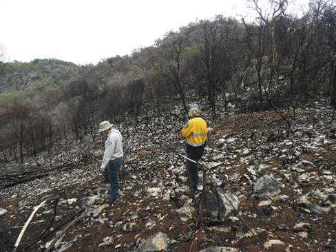
The Mount Etna fire burned approximately 752 hectares in total including 432 hectares on the National Park. The fire intensity was patchy across the fire area with numerous areas of full crown burns both in eucalypt dominated and vine thicket/forest communities.
This assessment report identifies potential risk to the environment with a focus on park estate including significant risk of fire recurrence from incursion of exotic high biomass grasses. The assessment report provides a snapshot of the identified risks following the wildfire event and provides practical treatment solutions and approximate costs for risk mitigation.