
Hazard and risk
On this page:
About
Leading state hazard and risk management functions became a Queensland Reconstruction Authority (QRA) responsibility on 1 July 2024 following reforms to Queensland’s Disaster and Emergency Management system. The reforms resulted in an increase in capacity and capability for QRA to lead statewide prevention, mitigation, preparedness and risk reduction activities, alongside current resilience and recovery operations. This includes specialists working in the areas of Flood Risk Management, Hazards, Risk & Resilience, and Geographical Information Systems (GIS) as well as initiatives in community engagement and education, and community awareness campaigns.
Hazard and risk
Frequently Asked Questions (FAQs)
Yes.
Leading state hazard and risk management functions became a QRA responsibility on 1 July 2024, following reforms to Queensland’s Disaster and Emergency Management system. The Hazard and Risk Unit has been established in QRA, combining the new Hazards, Risk & Resilience (HRR) team, with QRA's well established Flood Risk Management and GIS teams. The new HRR team is developing a revised state-level hazard and risk assessment approach.
A revised version of the QERMF (Version 2) was developed by the former QFES Hazard and Risk Unit following an independent review into the QERMF. The full release of this updated version of the QERMF was put on hold, due to the broader reforms to Queensland’s disaster and emergency management services and transitioning of responsibilities for this framework.
QRA is now developing a new Queensland Hazard and Risk Assessment Framework (QHRAF), to better align with stakeholder requirements and address recommendations received from the 2020 Independent review of the QERMF. QRA has undertaken stakeholder consultation to inform the development of the QHRAF and associated tools.
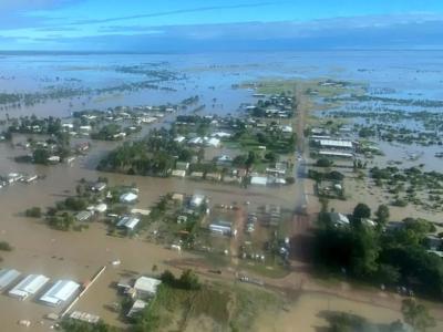
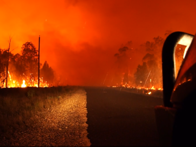
QRA’s hazard and risk focus will centre initially on the top ten hazards at the State level for Queensland identified by the 2023 State Disaster Risk Report (PDF) (external link), namely:
1. Flooding
2. Tropical cyclone
3. Bushfire
4. Severe thunderstorm
5. Heatwave
6. Pandemic
7. Biosecurity
8. Chemical, biological, and radiological
9. Earthquake
10. Tsunami
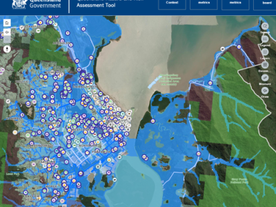
Subject to final approval by government, the QHRAF seeks allow users to understand the risks posed to assets by hazards and guide investment and risk reduction activities. It seeks to incorporate a Handbook, Methodology, GIS Tool (and GIS Tool User Guide) and Leading Practice Guidance. The QHRAF has been co-designed through a series of stakeholder engagement activities to ensure they are locally appropriate, fit-for-purpose and cost-effective. The QHRAF has been designed to build community resilience and support strategic risk-based planning. Consideration has also been given to the capacity of local government to effectively implement the new approach.
We greatly appreciate and value the significant contributions stakeholders have already made to existing risk assessments. The new approach seeks to build upon this foundation by ensuring prior efforts and data are recognised.
Feedback has highlighted that capabilities and capacity vary significantly amongst Councils.
QRA is committed to ensuring that the QHRAF is streamlined and accessible to all capacity levels. Where gaps in capability and capacity are identified, support will be provided via QRA’s Resilience and Recovery Officers (RROs) to ensure the approach can be effectively implemented.
Yes. QRA have engaged with other jurisdictions and methodologies as part of the design process and have leveraged best practice where possible.
A variety of outputs can be produced from the new QHRAF including, a comprehensive risk ranking of hazards for each local government area and priority risk statements.
Yes. The new approach is intended to support various activities, including the development of future Local Resilience Action Plans (LRAPs), noting there is a strong intention for LRAPs to become more "risk-informed." This integration would allow risk assessment outputs to contribute directly to enhancing and streamlining the LRAP process. The information in current LRAPs can also be verified through this process to inform broader resilience building activities.
Subject to final approval by government, it is anticipated the QHRAF documents will be made publicly available via the QRA webpage in 2026, while the GIS Tool will only be available to councils initially.
Contact the HRR team directly at hazard.risk@qra.qld.gov.au
Hazard and risk education and awareness websites

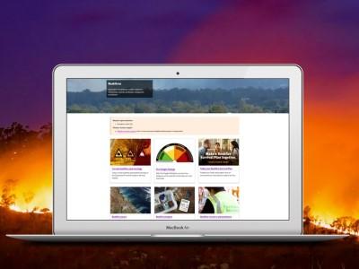
Community education and awareness campaigns


Media statements
Last updated: 2 June 2026. QRA Reference: QRA3967 & DOC/26/33445.